Flight planning for drone pilots
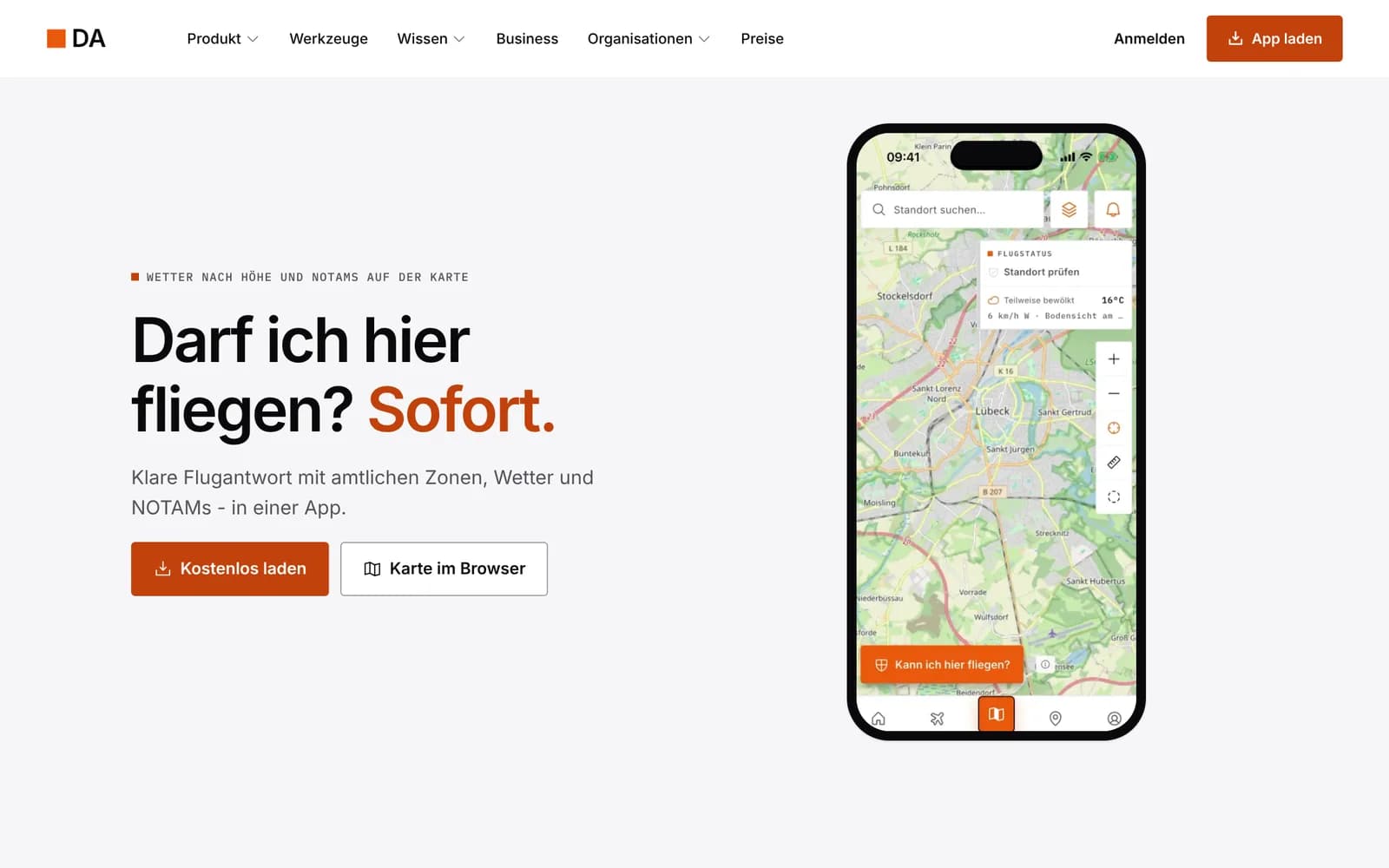
Can I fly here? Instantly.
DrohnenAtlas is the free, ad-free app for flying safely and legally in Germany. Flight zones come from the official DFS and dipul data, plus weather, NOTAMs, checklists, documents and a flight log. There is DrohnenAtlas Business for service providers, and Enterprise for authorities and companies.
App free, Business from €19 net per month
What it's about
Anyone launching a drone in Germany needs to know a lot beforehand: geo zones, control zones, nature reserves, NOTAMs, weather at flight altitude. The information is public, but spread across many sources. DrohnenAtlas puts it on one map and answers the one question that matters before every flight.
One tap on the map checks the location and sums up the result in one sentence, with source and date. After the flight, you import your DJI logs into the flight log and check them against the zones that applied on the day you flew.
We build DrohnenAtlas in Lübeck, as pilots for pilots. The app is a planning aid, not legal advice.
How it works
Tap a location
Zones, control zones, nature reserves, NOTAMs and weather at flight altitude for exactly that spot.
Plan the flight
Waypoints, crew, checklists and zone warnings, offline too in your region.
Document it
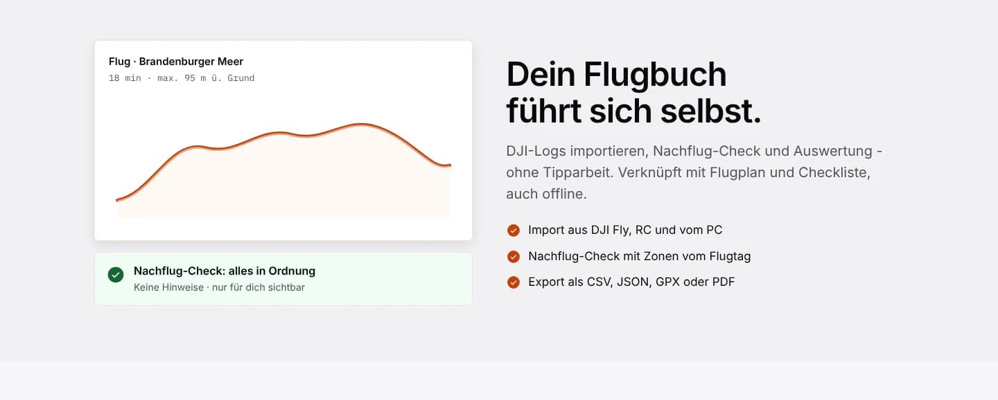
Import DJI logs, check them against the zones on the day you flew and export as CSV, JSON, GPX or PDF.
What DrohnenAtlas can do
Data sources: DFS and dipul for zones, BKG for geodata, DWD for weather. MCP server for AI assistants.
Flight check
Geo zones, control zones, nature reserves, NOTAMs and weather with one tap, with source and date.
Wind by altitude
Wind and weather for the altitude you actually fly at.
Flight log
Import from DJI Fly, RC or PC, post-flight check against the zones on the day you flew, export in four formats.
Documents
Competency certificates, insurance and eID with a reminder before they expire.
Mission planning
Flight plans with waypoints, crew and zone warnings.
Works offline
Checklists and documents without a connection, zone check offline in your region.
Free tools
Distance calculator, fine calculator, C-class check, licence finder and eID badge generator.
Business
Enquiry, quote, job and invoice. E-invoicing as ZUGFeRD or XRechnung, dunning, DATEV export.
Enterprise
Fleet, personnel, permits and mission documentation in one workspace, with SSO and SCIM.
Privacy and security
- Data sources
- DFS, dipul, BKG, DWD
- Ads
- none
- Platforms
- iPhone, iPad, Android, browser
- Enterprise data
- in Germany
- Login
- SSO and SCIM for Enterprise
- Note
- planning aid, not legal advice
Pricing
As of October 2026. Current prices at drohnenatlas.app. Further plans such as Pro at drohnenatlas.app.
App
€0
forever
- Zone check
- Flight log, documents, tools
Business Solo
€19
net per month
- Quotes, invoices, e-invoicing
- 14-day free trial
Enterprise
On request
with demo
- Fleet, personnel, permits
- SSO, SCIM, data in Germany
Who DrohnenAtlas is for
Hobby pilots
Know before every takeoff whether and how high you may fly.
Drone service providers
From quote to e-invoice with DrohnenAtlas Business.
Authorities and emergency services (BOS)
Missions, permits and documentation in one place, with dedicated packages for BOS and civil protection.
Companies with fleets
Personnel, devices and certificates in one workspace.
Frequently asked questions
Where does the zone data come from?
From the official data of DFS and dipul. BKG supplies the geodata and the German Weather Service (DWD) supplies the weather.
Is the app really free?
Yes. The app and the zone check are free and ad-free. Only Business and Enterprise are paid.
Does DrohnenAtlas work without a connection?
Checklists and documents work offline, and so does the zone check in your region.
Can I import my DJI flights?
Yes, logs from DJI Fly, RC or PC. DrohnenAtlas checks them against the zones on the day you flew.
Does DrohnenAtlas replace a permit?
No. DrohnenAtlas is a planning aid, not legal advice. Permit requirements still apply.
More products from the studio
 FormspringEvery customer touchpoint in one workspace: forms, surveys, funnels, bookings and links, with a shared inbox.
 SorrelWebsite intelligence in one Trust Score: compliance, security, vendor risk, accessibility and uptime.
 ScampilotSpot scam emails in seconds. An AI checks suspicious messages, emails and links and gives its verdict in plain language.
 BurrowA public HTTPS address for your local server, with one command. Hosted in the EU, the alternative to ngrok.
 SnareA free webhook inspector and request bin from the EU, plus over 20 small developer tools that log nothing.
 FlowwyHold fn, speak, let go. The text appears where your cursor is. Everything runs on your Mac.
 KestrelCapture, annotate, measure, copy. A fast menu bar screenshot tool with an editor and on-device text recognition.
Questions about DrohnenAtlas?
Plans, privacy, integration or feedback: write to us, and we'll reply personally.